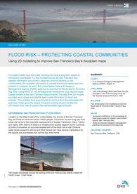
Helping keep the coastal communities of San Francisco Bay safe from floods
We helped the United States Federal Emergency Management Agency (FEMA) improve floodplain management practices for counties in the San Francisco Bay Area. We did so by examining the flood risks for the entire San Francisco Bay Area shoreline.
 We helped the United States Federal Emergency Management Agency (FEMA) improve floodplain management practices for counties in the San Francisco Bay Area. We did so by examining the flood risks for the entire San Francisco Bay Area shoreline.
Located on the West Coast of the United States, the shores of the San Francisco Bay are home to more than seven million people. The scenic but low-lying bay front areas are home to the corporate headquarters of Google, Facebook, Cisco, Yahoo! and Apple.
With billions of dollars of infrastructure located adjacent to the hundreds of miles of shoreline, an accurate assessment of the flood risk is vital. Extreme water levels caused by storms and other factors can have serious implications for the people and businesses that call the Bay Area home.
The San Francisco Bay Area has not had a comprehensive region-wide study since the early 1980s. Although innovative for its time, the previous study had several shortcomings. It relied on a limited number of tide gages that did not take measurements for a long enough period of time (with the exception of the Golden Gate Bridge tide gage). It also did not take into account the effect of waves. In addition, the study was inaccessible as the paper records had been archived. As such, the available information to identify flood prone areas was outdated or non-existent.
We utilised two-dimensional (2D) to improve upon the methods that were available in the previous study. Using MIKE 21, we develop 2D regional scale coastal models of the San Francisco Bay in order to predict:
- extreme tide (astronomical tide plus storm surge)
- swell entering from the Pacific Ocean
- sea waves generated from local winds in the Bay
The data from our models provided robust and reliable region-wide information for flood risk analysis. As such, the results were key components for the development of Flood Insurance Study (FIS) floodplain maps for the entire Bay Area. FEMA and its study contractors are using the regional model results as boundary conditions for further detailed coastal hazard analysis. This will also be the basis for most future studies.
By having a clearer idea of where flooding is most likely to occur, communities surrounding San Francisco Bay can take the appropriate measures to ensure their safety.
Read more