Our decision support tool VESNA has helped to effectively manage floods in Levice, Slovakia, where it has been successfully operational for the past three years.
Levice – a town in western Slovakia – is endangered by a small river called Podlužianka, especially after heavy rainfall events, when the water flows down the hilly catchment onto the flat, populated area. With 35,000 inhabitants in Levice, it was necessary to implement fast responses to such flood events in order to manage them effectively and mitigate their impacts.
For this purpose, we developed VESNA – a decision support tool oriented towards single-event heavy rainfall and consequent floods, with a typical delay of 8-12 hours after rainfall. The basic input for this tool is precipitation forecast. This is obtained from the weather model ALADIN, publically accessible via the internet on the web page of the Slovak Hydrometeorological Institute (SHMI).
On the basis of the total amount of the forecasted precipitation and the duration & degree of saturation of the catchment, the system selects a representative flood scenario. For the chosen flood scenario, the system then offers the following information to the user: .
- flood hazard and flood risk maps of Levice
- text description of flooding extent and advancement
- graphical animations and visualisations of flooding in the town and its surrounding areas
- recommendations for decisions and necessary action
- information on uncertainty
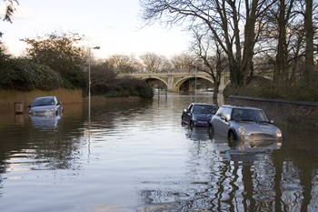 Photo: iStock © MikeGr Photo: iStock © MikeGr |
Simulations of flood scenarios are not calculated in real time during actual flood. They are instead calculated and mapped in advance.
We applied the following methods for assembling the VESNA tool:
- air born photogrammetry mapping
- rainfall-runoff modelling
- 1D and 2D hydrodynamic modelling
- bidirectional communication between GIS and the 2D hydrodynamic model
- simple fuzzy logic categories and decision tables
- compilation of the VESNA tool as an HTML page for use in a standard internet viewer
It is possible to launch the VESNA system from a flash memory stick or external hard drive on any PC equipped with a standard Internet browser. The system does not require any additional installation or licensed specialised software.